 links:
Dish Fishing images in Google Maps
|
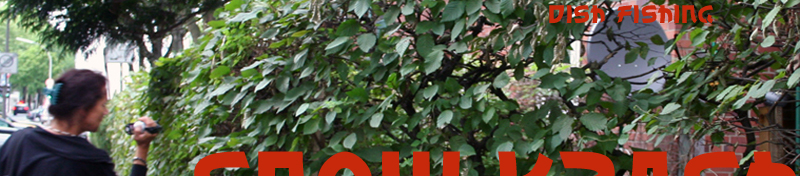
Dish Fishing
examines social structures of urban life through the process of satellite dish spotting on the facades of the
inner city. We see the symbols of telecommunicative connections to the world and even space in these seemingly mundane objects. We hear transformed electromagnetic currents, flowing freely across all physical and political boundaries. At the same time new systems of organisation are created that structure our world socially and culturally.
The idea for Dish Fishing was developed during our participation in the
Satellite/Border/Footprint Workshop
in Dortmund (31. July - 2. August 2010)
Lisa Parks
(Santa Barbara, US) at PHOENIX Halle Dortmund, organized by
Hartware MedienKunstVerein
in the frame of GrenzGebietRuhr.
|
Dish Fishing
beschäftigt sich mit den sozialen Strukturen
des Stadtlebens, die sich dem Beobachter beim Aufspüren
der Satellitenschüsseln an den Häusern der Innenstädte erschliessen.
Wir sehen die Zeichen der telekommunikativen Verbundenheit mit
der Welt, sogar dem Weltraum in den Schüsseln, wir hören transformierte
Elektroströme, die sich ohne Grenzen verbreiten, aber wir schaffen
uns angesichts dieser Phänomene auch neue Ordnungssysteme, in
diesem Fall soziokultureller Art, mit Hilfe derer wir unsere Welt strukturieren.
|
|
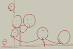
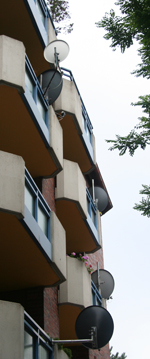
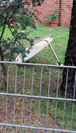
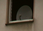
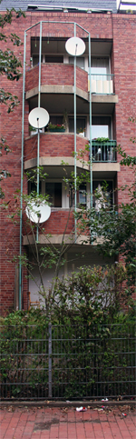
Field Work As practical part of the workshop, we chose to do some
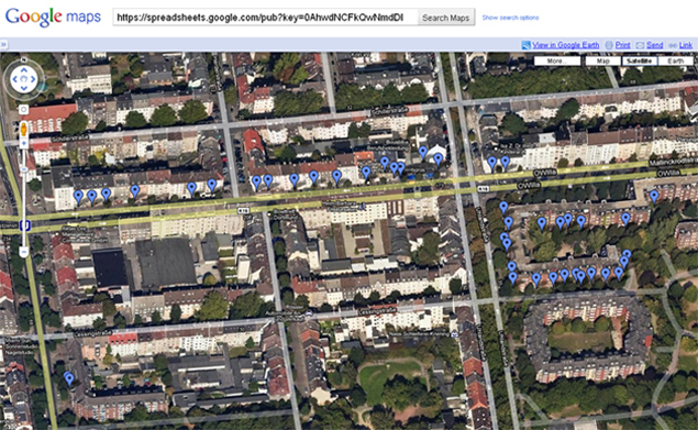
„Field Work“ in a section of northern Dortmund, searching roofs and façades for satellite dishes. We counted, photographed and filmed all of the dishes in the courtyards of Uhlandstrasse 35 – 43 and a stretch of Mallinckrodtstrasse from 165 to 221. Another “control” image was made of an area in which almost identical buildings, built by the same building company reveal no visible evidence of satellite dishes. Using the logged GPS tracking coordinates of our excursion, we made a layer in which the images can be viewed in Google Earth or Google Maps.
In their capacity as “complexity-reducing-Signifiers” , the satellite dishes are not only a part of the system “satellite”, but are also to be considered in the realm of gentrification, a sociological component of urban development. But, why should we not consider them simply as optical phenomena, an “almost” natural element of the urban fauna. Some of our photos do indeed reveal a kind of organic organisation...
The videos "Phoenix" and "Jenseits von Dortmund" in the video project
"Look at me now!?" use images and audio material recorded during the workshop in Dortmund.
View the Dish Fishing images as a layer in Google Earth or Google Maps >>>
|
Feldarbeit
Im Rahmen des Workshops haben wir uns entschlossen, einige ausgewählte Dortmunder Straßen daraufhin zu untersuchen, ob und wie viele Satellitenschüsseln sich an Wänden und Dächern der Häuser befinden. Unsere Dokumentation besteht aus mehreren Elementen: Wir haben die Satellitenschüsseln in einem vorher abgesteckten Karrée der Dortmunder Nordstadt fotografiert, gezählt und kartographisch eingeordnet. Das Ergebnis lässt sich als Layer bei Google Earth oder Google Maps anschauen.
In ihrer Eigenschaft als komplexitätsreduzierende Zeichen sind die Empfangsschüsseln nicht nur Bestandteile des Systems „Satelliten“, sondern gehören auch in den Bereich der Gentrifizierung, eine soziologische Komponente des Städtebaus. Warum sollte man sie nicht ebenso als optisches Phänomen, `fast´ natürlicher Bestandteil der urbanen Fauna, betrachten? Einige unserer Fotos legen dies durchaus nahe...
Auch die Videos "Phoenix" und "Jenseits von Dortmund" des Video Projekts
"Look at me now!?" sind aus Bild- und
Klangmaterial des Dortmunder Workshops entstanden.
Die Dish Fishing images als layer in Google Earth oder Google Maps anschauen >>>
|
|